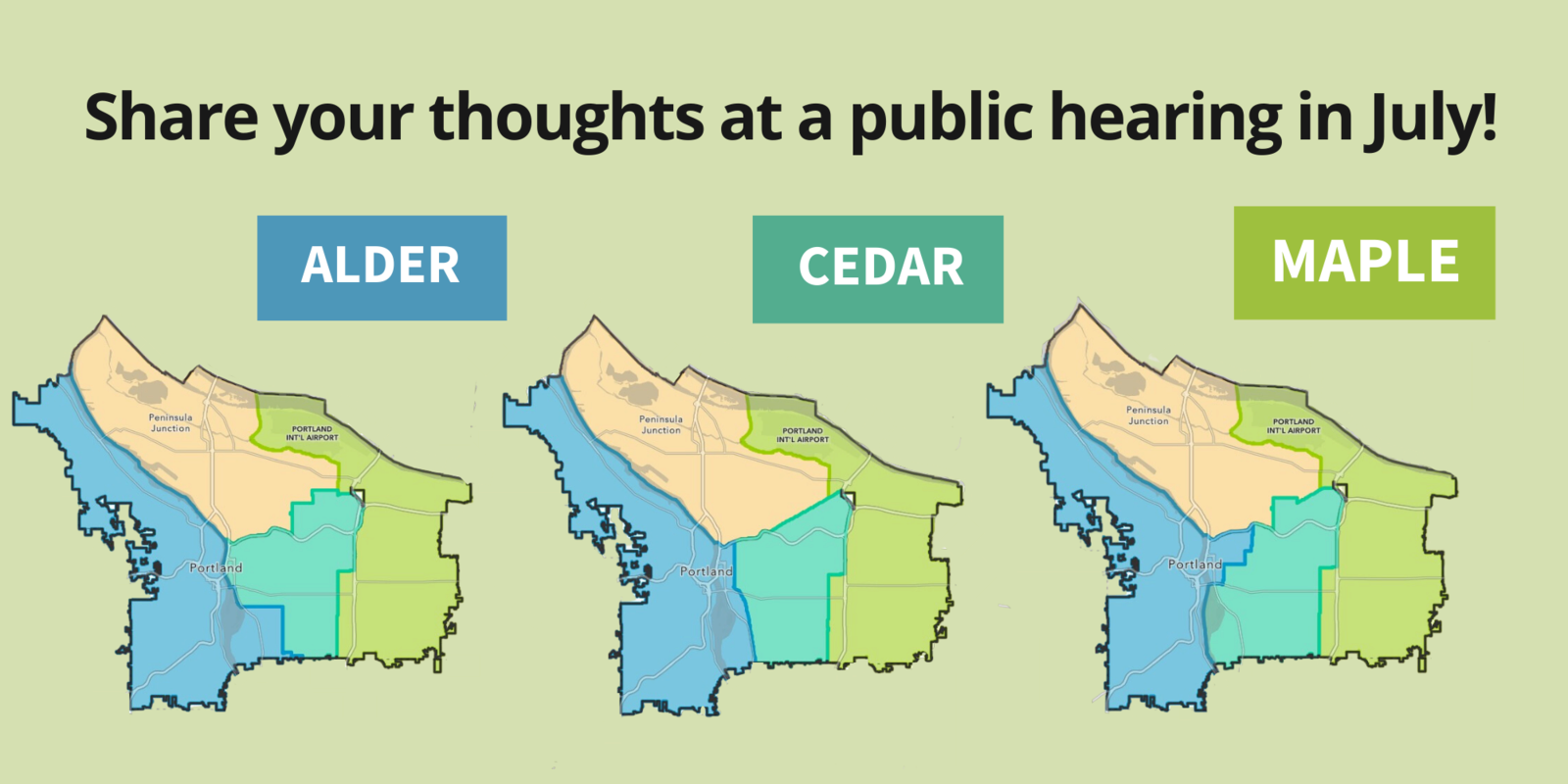
A Portland commission is soliciting Portlanders’ opinions on how to carve up the city into four equal City Council districts. In the past, Portland was represented by commissioners elected in citywide races. But next year, under a change of government approved by voters last year, there will be four geographic districts.
But where those districts will be is under consideration right now. The Independent District Commission has put out three options to consider. Here are some of the differences:
Alder Map:
- Lines are generally drawn along neighborhood boundaries.
- The central city is split up — into three districts, with the Willamette River and I-84 as dividing lines.
- Sellwood-Moreland is lumped with the westside neighborhoods.
Cedar Map:
- The lines are drawn along big streets and transit corridors: Northeast Sandy, Southeast 12th Ave, 82nd, and MAX lines.
- Parts of the Central Eastside and southeast Portland are lumped in with the westside district.
Maple Map:
- The central city is kept in one district.
- The Central Eastside, Buckman, and Kerns are in the same district as Goose Hollow, Old Town, University, and South Waterfront, and the whole westside is in that district too.
Do you have a view? There are many ways to voice your opinion:
Testify in Person
- Wednesday | 6 - 8 p.m. | Downtown
- Thursday | 6 - 8 p.m. | Boise
- Saturday | 12 - 2 p.m. | Portsmouth
- Sunday | 1 - 3 p.m. | Centennial
Testify Virtually
- Friday | 12 - 2 p.m. | Zoom
Written Testimony by July 22
- Fill out a public comment form.
- Call 311 to share your thoughts.
- Email them in.
- Mail them in.
Next Steps on Map
The commission will vote in August, and the maps will be finalized if at least nine of the 13 commissioners agree on one of the options.
If they don’t get nine votes, City Council will have the final say.